
The Trails  /  New South Wales

Great North Walk

Macquarie Place, Sydney to Newcastle

Registered Bicentenary Walking 250 km 16 days Easy to hard
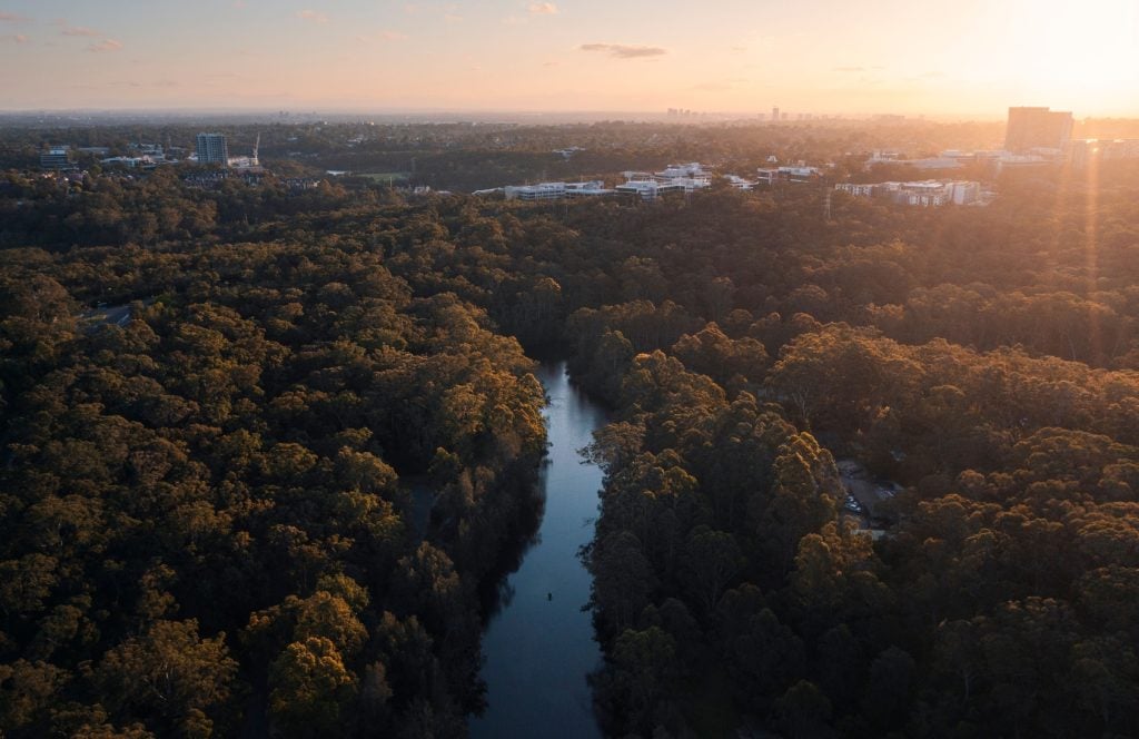
Lane Cove National Park on the Great North Walk

Lane Cove National Park. Image courtesy of Destination NSW

Places along the way

From the zero mile to the Hunter.

A walk that leaves the city by ferry and ends at another harbour sixteen days north, through Lane Cove and Berowra, across the Hawkesbury, over the Watagans and down to Newcastle. The first sections are easy day walks on train and ferry lines; the middle is rugged sandstone country where planning is essential.

1

Macquarie Place obelisk

Zero mile

The 1818 sandstone obelisk in Macquarie Place was the point from which the colony measured the roads of New South Wales for nearly two centuries. The walk starts here and heads for the ferry.

Listen to this place
2

Woolwich and Hunters Hill

Across the water

A ferry ride across the harbour lands at Woolwich Wharf, and the trail picks up through the sandstone villas and old streets of one of Sydney’s oldest suburbs to Boronia Park.

Listen to this place
3

Lane Cove and Berowra Valley

Into the bush

Beyond the suburbs the walk enters Lane Cove National Park and the Berowra Valley, sandstone cliffs, mangrove creeks, eucalypt forest and Aboriginal rock engravings, before crossing the Hawkesbury.

Listen to this place
4

The Watagans to Newcastle

Journey’s end

Over the Watagan mountains and down through the Hunter, the walk reaches Newcastle Harbour, the second harbour of the journey and its end.

Listen to this place

History and First Nations stories

A bicentenary gift, walked for a generation.

The Great North Walk was created in 1988 to mark the Bicentenary, linking the colony’s founding harbour with the Hunter through country that had been travelled for thousands of years before the roads it commemorates. The rock engravings, middens and shelters along the sandstone valleys carry that older story, and the walk is best understood as passing through it rather than starting at the obelisk.

National registration honours both journeys, the colonial measuring point and the Aboriginal country the route crosses, and tells them together.

Stories connected to Country are told only with, and as guided by, their custodians, under the First Nations custodianship protocols at the centre of the register’s governance.

Plan this journey

Itineraries, transport and places to stay.

A sample sixteen day walking itinerary is shown below. The southern sections are easy day walks with trains and ferries at each end; the northern sections are challenging and need planning, water and camping gear.

Day 1 · Sample itinerary

Macquarie Place to Boronia Park

Six kilometres from the obelisk and a ferry across the harbour to Woolwich, through Hunters Hill, rated easy to moderate.

Days 2 to 5

Lane Cove to the Hawkesbury

Through Lane Cove National Park and the Berowra Valley to Brooklyn, with train stations close to the trail at every stage.

Days 6 to 11

Brisbane Water to the Watagans

The wild middle of the walk, rugged sandstone country and forest, where campsites and water must be planned.

Days 12 to 16

The Hunter to Newcastle

Down from the Watagans through the Hunter Valley to the harbour at Newcastle.

Itinerary shown is indicative, prepared for the register’s pilot phase. Final itineraries, transport connections and weather feeds publish with the trail’s national launch.

For schools, walkers and researchers

Take the trail with you.

Support the Trails Donate Become a member